June 19, 2017
Without a plan, things can’t go according to plan.

Quick geography lesson: the red is the province of Newfoundland and Labrador. Labrador is the big red area on the continent, Newfoundland is the island. We are exploring Newfoundland for a week and a half in our Sprinter van.
June 19th 6:00 AM
As Monday mornings go, this will be one to remember. I am boiling water for coffee, while Karen and the kids are still asleep in the van. They are each slotted into a shoulder width space around and on top of the bench seat, in front of the platform where I did my best to sleep on top of our packed tent, crammed between our bikes and the wall of the van. The wind and rain have momentarily subsided, and jumbo mosquitos are window-shopping along the extensive glass of the Sprinter.
We are in Labrador.
The short version of how we got to this point is still fairly long: I drove the van for two days and rode one overnight ferry to Newfoundland. Drove another half day into the province to pick up Karen and the kids in Deer Lake, where they arrived on a small AirCanada jet in near daylight at 8:30 pm on Saturday.

Only a handful of people were arriving in Deer Lake, Newfoundland. Karen and the kids flew in from Montreal three days after I left Vermont.
After three beautiful days of driving, it began raining the moment we left the airport. This was fine, since we had a hotel, and the hotel had a pool. The next morning, facing an unfavorable weather forecast, we made what has become, by now, a predictable decision: we just climbed into the van and pointed it North.
The predictability of our decision is a consequence of our entire trip itinerary, which consists of exactly two items: an arrival date and location and a departure date and location. The rest is a series of make-it-up as you go along days. Our curiosity for what’s around the corner, at the end of a road, on the other side of a river, behind a door, or within a park or attraction dictates where we go. These are easy curiosities to satisfy, because they are all optional. We can stop, turn, or keep driving. We are bookended only by daylight, which forces us to make the hardest of our daily decisions: where will we camp tonight?
In most cases, this is easy. Before departing for a day (or sometimes from lunch), we will consult the map or talk with other travelers and locals to identify a state/national/municipal park with camping and choose that as our destination. We may note a couple of other nearby camping options in case plans change. Most campgrounds keep a percentage of sites unreserved for drop-ins like us and unless it is a Friday or Saturday night, we can usually arrive at any hour and get a spot.
And so it was with our trip yesterday. As we rolled through Gros Morne National Park and then north along the western coast of Newfoundland (aka the “Viking Trail”) the rain and sea spray blowing across the road didn’t exactly invite us to get out and do much of anything, let alone think about camping. So we kept driving, admiring the small fishing villages and making a couple of stops.

We ate lunch at a small cafe behind the fish processing plant in Port au Choix, Newfoundland. Fresh cod and moose burgers. Yum!

Mandatory stop. Mandatory photo.
About three hours into our drive, we saw a sign for the ferry across the Strait of Belle Isle and asked ourselves: “Hmm, wonder what Labrador looks like?”
One left turn and a swipe of the credit card later, we were lined up with the commercial vehicles for the hour and a half crossing. We estimated that our arrival at Pinware Provincial Park in Labrador would leave us with plenty of daylight to set up camp and make dinner.

Just like on our local ferry between Shoreham, VT and Ticonderoga, NY, the regulars chat with the crew while tourists (in this case, us) make a bigger deal of the trip than it is.

While waiting for the ferry to load, we took a walk around the rugged coastline.
Loading the ferry was a long and complicated affair, since big vehicles like ours were actually small in comparison to the commercial truck traffic. Once on board, I was directed to snuggle the van right up tight to the ferry hull. So tight that even with the mirrors tucked in, my door didn't have room to open and I had to exit from the passenger slider. We finally pulled away from the ferry dock nearly an hour later than scheduled. The delay didn’t worry us. At 52 degrees north latitude, we would still have plenty of light at the campsite.
We noticed the first icebergs within 10 minutes of departure, but the rest of the crossing was typical north Atlantic sailing: foggy with no discernible horizon, and a rolling swell included for good measure. We put the playing cards away and concentrated on not letting the ingredients for seasickness reveal their chemistry.
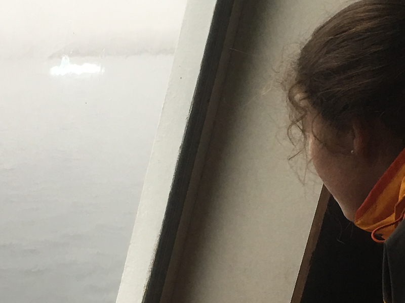
Thanks to the rain, the view of our first iceberg through the ferry window wasn't very clear. But it was still a unique thrill to see one floating by!
The ferry actually lands in Quebec, but within a few kilometers we crossed the line into Labrador, and joined the local pickup truck traffic from the ferry in the game of dodging potholes at high speed. This is a region that experiences some rough weather and the roads seem to take a beating.
About 45 minutes later we arrived at the park, assuming that it was unlikely to be crowded on a Sunday night in June. We were right. It wasn’t crowded at all. It was closed. According to the sign on the door of the ranger station, the cold spring had delayed the park opening until June 23rd, something the parks website had neglected to note when we checked it for the address earlier in the day. Despite all of the lights being on in the ranger station and the truck in the driveway, nobody answered the door. It didn’t seem right to drive over the closed tape and set up camp. We decided we needed to come up with an alternative solution.
I had read that camping on crown land is permitted in Newfoundland and Labrador (I read it on the internet, so it must be true) so our next option was to find a spot to “boondock”, which is to say, wild camp in an undesignated area. I had heard that lighthouses were often good camping sites and we had seen one in the previous village, so we turned around in search of the lighthouse. We quickly discovered that this particular lighthouse was on an island, so that was out of the question.
A small car-width path through some scrub brush had caught my attention as we drove to investigate the lighthouse, so we turned the van around, drove to the path and walked in to check things out. On the other side of the path was a clearing that was protected from the wind and invisible from the road. We were unclear whether this was public or private land, but it appeared to be our only option, so in we went. The noises of the brush scraping along the van as we squeezed our way through bothered me less than you would think.
Our typical camp set-up regimen consists of hauling out and setting up our tent, loading the cots and sleeping bags, and then making some dinner, all in fairly quick fashion. But with the weather and the waning light, we weren’t too keen to drench the tent and sleeping bags on our first night. Plus, by now, we were all really hungry and skipping the set up meant eating sooner. As the water boiled for mac n’ cheese and hot dogs (our quickest and most filling meal available) we tossed around some ideas about how we might all fit into the van to sleep. The kids and I had tried sleeping in the van once on our cross country trip in 2015 and found that it was kind of a pain to set up and not a very satisfying night sleep, but we had some new ideas this time around. I was game to try it since in addition to protection from the elements, sleeping in the van also meant that if we were discovered in the middle of the night, we could make a quick departure.

Twlight dinner. 10 pm in Labrador, and yes, that is an iceberg on the horizon!
We positioned the van on the most level spot we could find and laid out a sleeping bag for Kellan on the floor, one for Karen on the bench seat, one for Julia across the bags behind the seat and mine next to the bikes on the platform. In theory it looked like it just might work. So we put it to the test.

Success! Three of the four of us slept really well. The fourth took pictures of others sleeping well.
The coffee tastes especially great this morning. Nobody found us, the rain has paused, there’s an iceberg floating by and we are having an actual adventure so far. Once everyone else is awake, we’re going to head farther north to check out the small town of Red Bay and to have some breakfast. We’ll ferry back to Newfoundland this afternoon and hopefully I’ll find some wifi or cell service to get this posted!

The Road to Red Bay, Labrador.